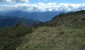
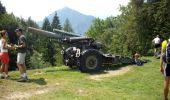
![](/images/other/stat-length.png)
![Tocht Te voet Tremosine sul Garda - Malga Spiazzo, Malga Lavino, Bocca di Lorina - Photo](https://media.geolcdn.com/t/1900/400/14fb5565-3028-4e19-b895-517d359cc4bd.jpeg&format=pjpeg&maxdim=2)
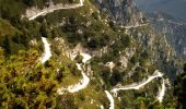
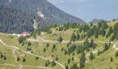
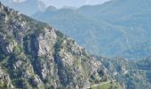
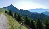
Malga Spiazzo, Malga Lavino, Bocca di Lorina
SityTrail - itinéraires balisés pédestres
Tous les sentiers balisés d’Europe GUIDE+
![Lengte](/images/other/stat-length.png)
Lengte
17,3 km
![Max. hoogte](https://static1.geolcdn.com/siteimages/upload/files/1508320355ic_sort_altitude_max_24dp.png)
Max. hoogte
1856 m
![Positief hoogteverschil](https://static1.geolcdn.com/siteimages/upload/files/1508320355ic_sort_den_pos_24dp.png)
Positief hoogteverschil
665 m
![Km-Effort](/images/other/stat-length.png)
Km-Effort
27 km
![Min. hoogte](https://static1.geolcdn.com/siteimages/upload/files/1508320355ic_sort_altitude_min_24dp.png)
Min. hoogte
1192 m
![Negatief hoogteverschil](https://static1.geolcdn.com/siteimages/upload/files/1508320355ic_sort_den_neg_24dp.png)
Negatief hoogteverschil
900 m
![Boucle](https://static1.geolcdn.com/siteimages/upload/files/16400158638029165_repeat_loop_refresh_sync_direction_icon.png)
Boucle
Neen
Markering
Datum van aanmaak :
2022-02-15 01:32:57.982
Laatste wijziging :
2022-02-28 21:00:05.594
![Te voet](https://static1.geolcdn.com/sitytour/trail-icons/100.png)
6h08
Moeilijkheid : Medium
![Scan deze QR-code om de tocht te openen in de SityTrail-applicatie](https://capi.geolives.com/qq0zvz2zws4bq2lad0pu/sitytour/trails/3113392/qr.png?size=200)
Gratisgps-wandelapplicatie
Over ons
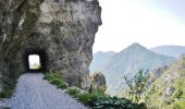
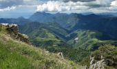
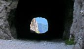
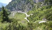
Tocht Te voet van 17,3 km beschikbaar op Lombardije, Brescia, Tremosine sul Garda. Deze tocht wordt voorgesteld door SityTrail - itinéraires balisés pédestres.
Beschrijving
Trail created by Comune di Tremosine.
Plaatsbepaling
Land:
Italy
Regio :
Lombardije
Departement/Provincie :
Brescia
Gemeente :
Tremosine sul Garda
Locatie:
Unknown
Vertrek:(Dec)
Vertrek:(UTM)
628092 ; 5074023 (32T) N.
Opmerkingen
Wandeltochten in de omgeving
![Tocht Te voet Magasa - Passo della Puria, Monte Caplone, incr. 444 - Photo](https://media.geolcdn.com/t/375/260/f5fa77b8-8205-482f-ae3b-b7859130fe61.jpeg&format=jpg&maxdim=2)
![Te voet Te voet](https://static1.geolcdn.com/sitytour/trail-icons/100.png)
Passo della Puria, Monte Caplone, incr. 444
Te voet
Gemakkelijk
Magasa,
Lombardije,
Brescia,
Italy
![](/images/other/stat-length.png)
5,6 km | 12,3 km-effort
2h 47min
![](https://static1.geolcdn.com/siteimages/upload/files/16400158638029165_repeat_loop_refresh_sync_direction_icon.png)
Neen
![Tocht Te voet Storo - IT-O467 - Photo](https://media.geolcdn.com/t/375/260/2fad1500-2447-4435-a451-c153f62ac57e.jpeg&format=jpg&maxdim=2)
![Te voet Te voet](https://static1.geolcdn.com/sitytour/trail-icons/100.png)
IT-O467
Te voet
Medium
Storo,
Trento-Zuid-Tirol,
Provincia di Trento,
Italy
![](/images/other/stat-length.png)
10,5 km | 24 km-effort
5h 20min
![](https://static1.geolcdn.com/siteimages/upload/files/16400158638029165_repeat_loop_refresh_sync_direction_icon.png)
Neen
![Tocht Te voet Magasa - Bivio Camiöl (Magasa) - Bocca alla Croce (Valvestino) - Photo](https://media.geolcdn.com/t/375/260/580ecafd-ad64-4f47-8c09-961c31257996.jpeg&format=jpg&maxdim=2)
![Te voet Te voet](https://static1.geolcdn.com/sitytour/trail-icons/100.png)
Bivio Camiöl (Magasa) - Bocca alla Croce (Valvestino)
Te voet
Gemakkelijk
Magasa,
Lombardije,
Brescia,
Italy
![](/images/other/stat-length.png)
3,5 km | 6,1 km-effort
1h 23min
![](https://static1.geolcdn.com/siteimages/upload/files/16400158638029165_repeat_loop_refresh_sync_direction_icon.png)
Neen
![Tocht Te voet Valvestino - Armo (Valvestino) - Ponte Franato - Denai (Magasa) - Photo](https://media.geolcdn.com/t/375/260/c27f382b-c73c-4664-bd37-2b51f6ebbd18.jpeg&format=jpg&maxdim=2)
![Te voet Te voet](https://static1.geolcdn.com/sitytour/trail-icons/100.png)
Armo (Valvestino) - Ponte Franato - Denai (Magasa)
Te voet
Gemakkelijk
Valvestino,
Lombardije,
Brescia,
Italy
![](/images/other/stat-length.png)
10,7 km | 19,8 km-effort
4h 30min
![](https://static1.geolcdn.com/siteimages/upload/files/16400158638029165_repeat_loop_refresh_sync_direction_icon.png)
Neen
![Tocht Te voet Magasa - Malga Casina, Bocca di Cablone, Malga Tombea - Photo](https://media.geolcdn.com/t/375/260/380e7a67-1ed1-419f-bf9f-5819034ffc9b.jpeg&format=jpg&maxdim=2)
![Te voet Te voet](https://static1.geolcdn.com/sitytour/trail-icons/100.png)
Malga Casina, Bocca di Cablone, Malga Tombea
Te voet
Gemakkelijk
Magasa,
Lombardije,
Brescia,
Italy
![](/images/other/stat-length.png)
7,4 km | 10,4 km-effort
2h 21min
![](https://static1.geolcdn.com/siteimages/upload/files/16400158638029165_repeat_loop_refresh_sync_direction_icon.png)
Neen
![Tocht Te voet Tignale - Magasa (Cima Rest) - Passo Puria - Photo](https://media.geolcdn.com/t/375/260/46598e88-334c-4dea-b728-deebc19dcf18.jpeg&format=jpg&maxdim=2)
![Te voet Te voet](https://static1.geolcdn.com/sitytour/trail-icons/100.png)
Magasa (Cima Rest) - Passo Puria
Te voet
Gemakkelijk
Tignale,
Lombardije,
Brescia,
Italy
![](/images/other/stat-length.png)
8 km | 12,7 km-effort
2h 52min
![](https://static1.geolcdn.com/siteimages/upload/files/16400158638029165_repeat_loop_refresh_sync_direction_icon.png)
Neen
![Tocht Te voet Tignale - Cima Rest (Magasa) - Passo di Scarpapè (Tignale) - Photo](https://media.geolcdn.com/t/375/260/25e68857-ae9c-4134-a8e6-7e958665c5ac.jpeg&format=jpg&maxdim=2)
![Te voet Te voet](https://static1.geolcdn.com/sitytour/trail-icons/100.png)
Cima Rest (Magasa) - Passo di Scarpapè (Tignale)
Te voet
Gemakkelijk
Tignale,
Lombardije,
Brescia,
Italy
![](/images/other/stat-length.png)
6,7 km | 11,1 km-effort
2h 31min
![](https://static1.geolcdn.com/siteimages/upload/files/16400158638029165_repeat_loop_refresh_sync_direction_icon.png)
Neen
![Tocht Te voet Magasa - Droanello (Gargnano) - Cima Rest (Magasa) - Photo](https://media.geolcdn.com/t/375/260/85ad8e13-3b08-42cc-86db-701e2392570a.jpeg&format=jpg&maxdim=2)
![Te voet Te voet](https://static1.geolcdn.com/sitytour/trail-icons/100.png)
Droanello (Gargnano) - Cima Rest (Magasa)
Te voet
Gemakkelijk
Magasa,
Lombardije,
Brescia,
Italy
![](/images/other/stat-length.png)
5,9 km | 8,3 km-effort
1h 52min
![](https://static1.geolcdn.com/siteimages/upload/files/16400158638029165_repeat_loop_refresh_sync_direction_icon.png)
Neen
![Tocht Te voet Tremosine sul Garda - San Michele, Malga Lorina - Photo](https://media.geolcdn.com/t/375/260/058422c6-93ca-4113-a2a0-832fecaf5664.jpeg&format=jpg&maxdim=2)
![Te voet Te voet](https://static1.geolcdn.com/sitytour/trail-icons/100.png)
San Michele, Malga Lorina
Te voet
Gemakkelijk
Tremosine sul Garda,
Lombardije,
Brescia,
Italy
![](/images/other/stat-length.png)
8,7 km | 13,3 km-effort
3h 0min
![](https://static1.geolcdn.com/siteimages/upload/files/16400158638029165_repeat_loop_refresh_sync_direction_icon.png)
Neen